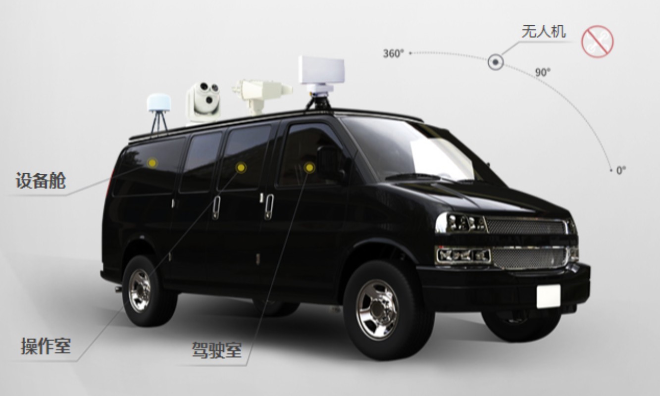
DongFangShaoBing Low altitude three-dimensional security system is the first generation of highly information-based, integrated and intelligent security system in China; The low altitude three-dimensional security system with completely independent intellectual property rights integrates the functions of target detection, detection, identification and positioning, tracking and early warning, monitoring and evidence collection, defense and countermeasures, realizes the active and passive three-dimensional security of air-to-ground joint observation and attack, and effectively curbs and combats various terrorist activities and illegal acts by means of UAVs.
● main hardware:
Radar: the detection range is 5km long and 500m high. (Dajiang spirit 4 is the reference target) the accuracy is less than 15m, and it can identify the photoelectric equipment of hovering UAV: the visible light length is 2km, and the infrared night vision is 1.5km.
● jamming equipment: linked with photoelectric equipment, with effective distance > 1.5km, it can automatically change the frequency to attack industrial UAVs in unconventional frequency band (the frequency change function needs to be equipped with spectrum equipment).
● have geographic location-based visual map information (GIS) and provide map command and operation function;
● display the overall UAV flight situation and early warning situation, continuously collect intelligence and provide intuitive command interface;
● be able to remotely control radar equipment, spectrum detection equipment, photoelectric forensics equipment and countermeasures equipment, and realize the integration and efficient cooperation of a variety of heterogeneous equipment; Capable of multi-dimensional analysis and detection of UAV, and can customize the display of flight information such as longitude and latitude coordinates, altitude, distance, moving speed and type of detection target according to user requirements;
● the multi-level early warning area can be customized according to the customer's needs. When the UAV enters the early warning area, the system will send out audible and visual alarm, and detect, track and dispose of targets ≥ 10 batches at the same time;
● be able to give priority to the detection targets with high threat level according to different threat levels of UAV;
● it has the function of detecting track playback, and can store video forensics to achieve well documented;
● it can store UAV intrusion and disposal logs, and the detection data storage time of detection equipment is more than 180 days;
● it can access the third-party storage, realize the long-term storage of countermeasures data, and retrieve the stored log data according to time and events, so as to facilitate the analysis and statistics of intrusion behavior, improve the defense strategy and continuously analyze the effectiveness;
● be able to continue in-depth learning according to the collected data and continuously improve the detected UAV characteristic data;
● provide equipment development interface, which can be integrated into other existing platforms of users with strong compatibility;
● each remote control platform has the functions of unified allocation and management of personnel;
● the background has multiple service modules such as authority management service, data storage service, data analysis service and equipment configuration service to provide intelligent comprehensive management;
● the system supports on-board deployment, military shelter deployment, fixed deployment, etc.
● the above indicators have passed the authority test of the Ministry of public security